


...continued from last post...
SC4 on the other hand was a place I could map out new things, and 3RR, once I realized it, was a particularly rewarding way for me to do that. I started Three Rivers Region as a four large quad (of course, I didn't call them that back then) region...
Phase 1 - March-May, 2006

...then, over the course of about six mad months, made it four times as large...
Phase 2 - May-October, 2006

...then larger once again to its current 16x16 quad size.
Phase 3 - October, 2006-current

Where did that map come from? In mid October, 2006, 3RR stood here- a region four quads by four (although it was divided a bit differently).
When I decided to increase the scale to something approximating RL, I first assembled all the terrain views from screenshots into a region size whole.

Next, I hand-drew contour lines in areas of elevation changes...

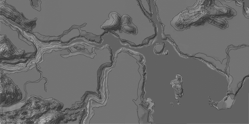
...then "painted" them in with a greyscale gradient recognized by wouanagaine's great SC4Terraformer...

...arriving ultimately at this.

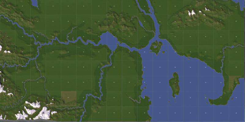
I then took the greyscale map and imported it into the Terraformer specifying a 16x16 quad (large city square) region size. Here's an early-on pic of what Terraformer gave me back.


Next, I opened each quad in SC4.

All 256 of them.

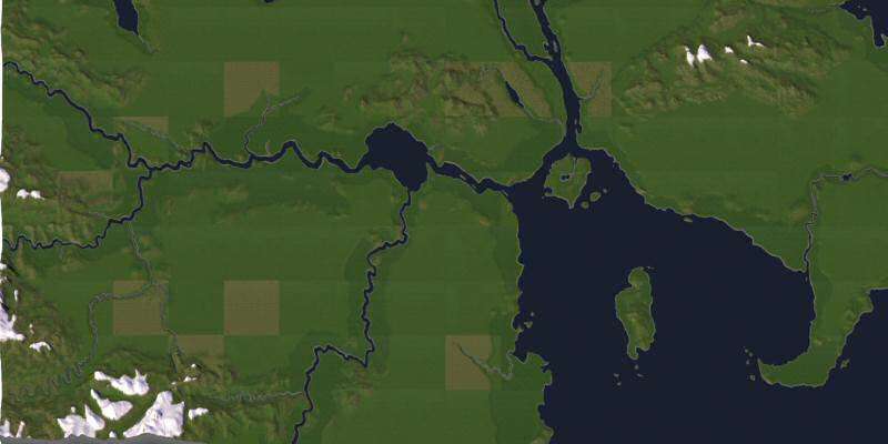
This process gave me this...

(and this, but we fixed it).

I did a first pass of general terraforming...

...that resulted in this...

...which I then fine-terraformed into this.

Took me about a month. What a long, strange trip it's been [linkie] from there.
[tabular type=4]
[row] [head colspan=5][/head][/row]
[row] [data][/data][/row]
[/tabular]
David
955862
SC4 on the other hand was a place I could map out new things, and 3RR, once I realized it, was a particularly rewarding way for me to do that. I started Three Rivers Region as a four large quad (of course, I didn't call them that back then) region...
Phase 1 - March-May, 2006
...then, over the course of about six mad months, made it four times as large...
Phase 2 - May-October, 2006
...then larger once again to its current 16x16 quad size.
Phase 3 - October, 2006-current
Where did that map come from? In mid October, 2006, 3RR stood here- a region four quads by four (although it was divided a bit differently).
When I decided to increase the scale to something approximating RL, I first assembled all the terrain views from screenshots into a region size whole.
Next, I hand-drew contour lines in areas of elevation changes...
...then "painted" them in with a greyscale gradient recognized by wouanagaine's great SC4Terraformer...
...arriving ultimately at this.
I then took the greyscale map and imported it into the Terraformer specifying a 16x16 quad (large city square) region size. Here's an early-on pic of what Terraformer gave me back.
Next, I opened each quad in SC4.
All 256 of them.
This process gave me this...
(and this, but we fixed it).
I did a first pass of general terraforming...
...that resulted in this...
...which I then fine-terraformed into this.
Took me about a month. What a long, strange trip it's been [linkie] from there.
[tabular type=4]
[row] [head colspan=5]
3RR Quotable Moment
[row] [data]
@dedgren: "3RR is probably a dead-end in the long term. But that's not to say we won't have fun getting to the end."
[/tabular]
David
955862


 -de
-de


 It's hard to believe it's been that long. I remember the old days of 4-quad 3RR . . . it was right around the same time I was starting out in the community. The ol' upsizing/scaling discussion was to me one of the most detailed and well-thought out discussions I've seen in a CJ/MD, and it definitely changed the way an entire generation of SC4 players viewed the game.